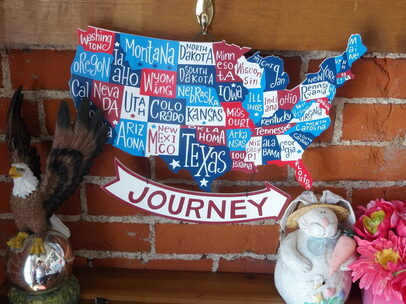
Our Website
Motor home life started for us in 2018 and soon after the Web-Page was created. In order to maintain the Web-Page we are asking that visitors consider a small donation to help defray the cost.
$1 Donation
Survival and More
New!
Coming Soon!
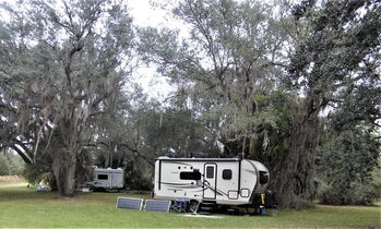
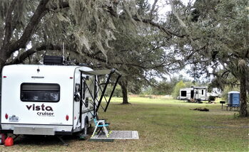
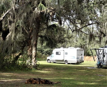
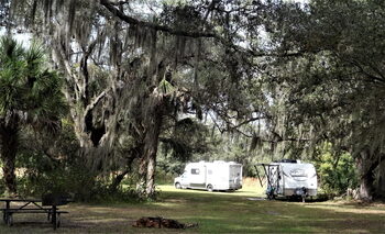
Campground Reviews
These reviews are from the many places we have actually stayed at. Hope that these will be helpful and we will be adding more as we move along our travels
Arizona
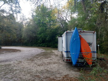
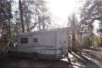
Kaibab FR 302 & Park Link BLM
November 5, 2021
Conestoga Charlie has a double header for all Arizona Travelers.
Two BLM Disbursed Campsites for ideal Boondocking.
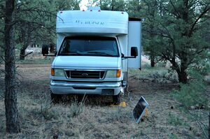
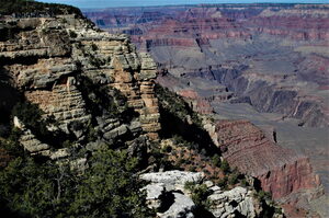
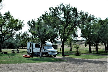
The first, Kaibab FR 302 Campground (GPS W-35.964619 N-112.108658) is just minutes away from the Grand Canyon National Park, and very easy to find.
Turn right just after the roundabout.
Large rigs will want to stay close to the main access road, which is a very good dirt road.
Sites farther in may pose clearance problems and have deep ruts.
Park entrance is $25 or Free with America the Beautiful pass holders.
The I-Max Theater has a great presentation of the history of the Grand Canyon.
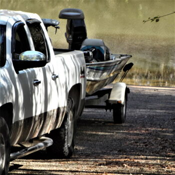
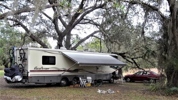
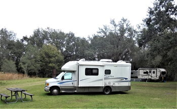
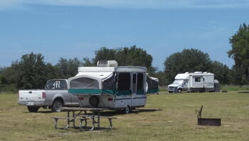
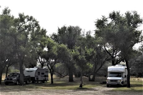
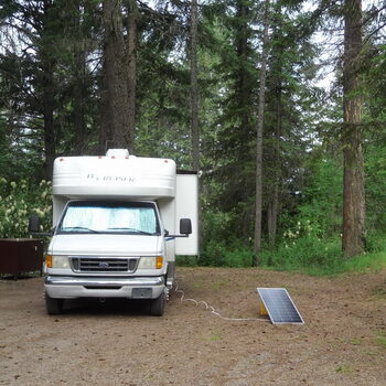
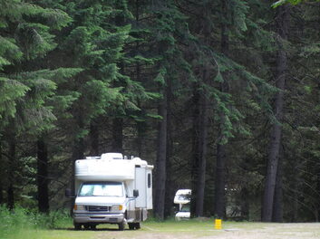
Fire Road 302 Campground Grand Canyon AZ 2021 |

Grand Canyon National Park Arizona 2021 |
Grand Canyon National Park Arizona 2021 |
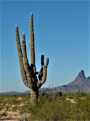
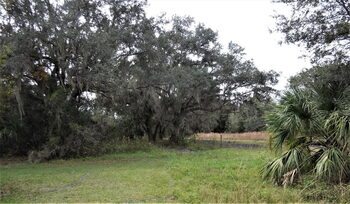
The second Park Link BLM Disbursed Camping W-32.610601 N-111.306501 is east of Tucson and is a quiet spot with a number of sites suitable for all sizes of RV’s
Take Red Rock exit from I-10 east to dead end, then make a left to Park Link Drive and turn right about 4 miles on paved road.
Picacho Peak is nearby with hiking and trails.
The Biosphere is farther down the road that leads to the campsites.
The Biosphere is now used by The University of Arizona and is a great side trip.
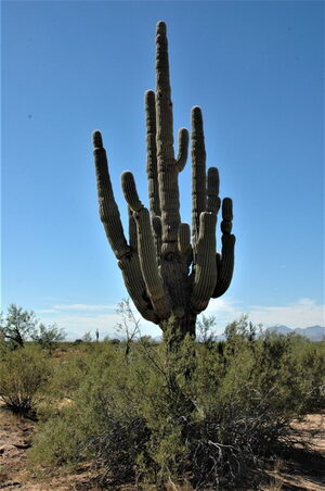
The nearby Saguaro National Park is worth a visit and There is a Flying J truck stop 16 miles east with propane and a dump station.
The high country of Arizona is going to be sub freezing so be prepared for some cold nights.
Southern Arizona may have a few warm days but nights are in the middle to high 50’s.
Last night was 53 and today’s high will be 91, however soon it will start to have cooler days mostly middle 60’s.
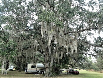
Saguaro and Picacho Peak |
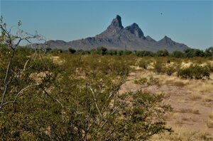
Picacho Peak |
Park Link BLM Camp 2021 |
Saguaro |
Park Link BLM Camp 1 & 2
November 9, 2021
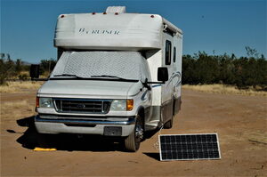
Conestoga Charlie and SunChaser moved to Park Link BLM Camp 1 (GPS N-32.610627 W-111.316532) today after dumping the holding tanks, refilling propane, and filling the fresh water tank about 17 miles east.
Both camp 1 and 2 have room for Class A with toad.
The entry road is more level at camp1.
Park Link BLM Camp 2 (GPS N-32.610601 W-111316532) is just up the same road about half a mile also has room for any rig.(Review in Nov. 5 Post)
We moved to Camp 1 after making a short trip to Eloy to Dump and Fill, as well as some shopping in Casa Grande (about 30 miles east)
Camp 1 has a small Mesquite Forest along a wash as well as Barrel Cactus Camp 2 has a prominent Saguaro Cactus.
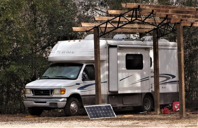
I have written that Solar is more than just producing Electricity.
It is important to also learn to conserve electric use especially if Boondocking.
Today’s photos include accessories that perform without electric use.
Our solar shower conserves propane, does not fill the holding tank, and nourishes the plant life.
The Tayama Thermal Cooker does the same job as an electric slow cooker and can have a meal ready upon reaching the destination as well.
The Manual food Chopper as well as stove top coffee, waffle iron, and toaster again save electric.

Stove Top Appliances Uses Negligible Propane compared to Electric |
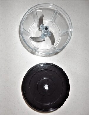
Manual food Chopper |
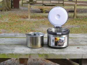
Tayama Thermal Cooker Performs the Same as Electric Slow Cooker |
Solar Shower in use |
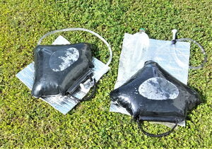
Solar Water Heaters |
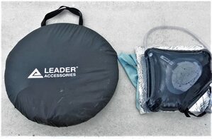
Leader Cabana and Solar Water Heater Ready for Transport |
Recently the refrigerator required replacement and even though the Norcold was more expensive in the long run it will be less expensive than a cheaper household unit, especially when depending on Solar Electric.
Also the new model refrigerator is far more efficient and uses much less propane than the old one.
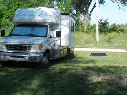
This is why for a little over a year we survived with only 270 Watts of Solar Panels.
My personal solar odyssey goes back to 2003 when kayaking down the Missouri River.
Florida
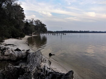
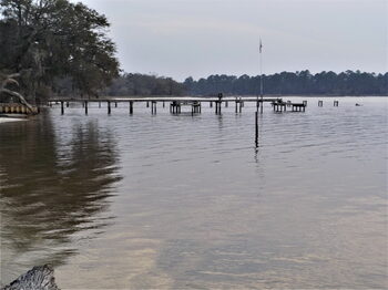
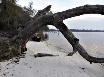
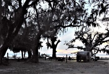
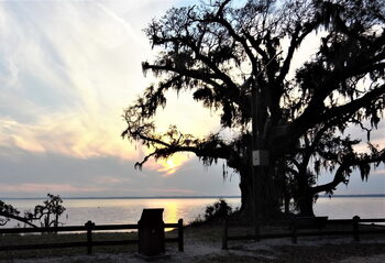
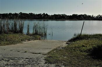
Mystic Springs WMD Campground
November 17, 2019
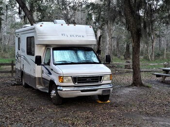
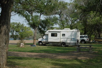
Back home again and Conestoga Charlie is camped at Mystic Springs WMD Campground.
There is no charge however reservations are required and obtained at https://nwfwater.com/Lands/Recreation/Area/Escambia-River/Mystic-Springs
(Latitude N 30.855512, Longitude W 87.311640), 591 Mystic Springs Rd Cantonment Florida 32533.
The stay limit on the site said 14 days which conflicts with what we saw on another site which said 7 days.
Mystic Springs Cove, Florida |
Mystic Springs Cove, Florida |
Mystic Springs Cove, Florida |
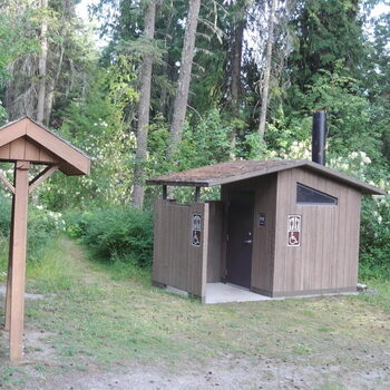
Chemical Toilet at Mystic Springs Cove, Florida |
On theBoat Ramp at Mystic Springs Cove, Florida |
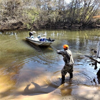
Launching at Mystic Springs Cove, Florida |
Fishing Boat at Mystic Springs Cove, Florida |
Mystic Springs Cove, Florida |
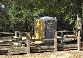
The Campsite has a boat ramp, Chemical toilet and trash cans.
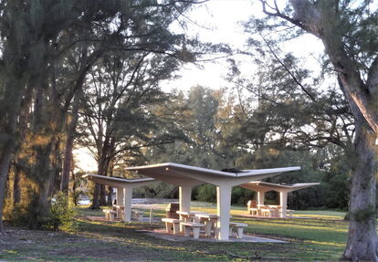
There is fire pit and BBQ Grill as well as Picnic Tables.
All the camp sites are shaded which helps keep cool but makes solar collection sporty.
We have moved 3 times trying to find a solar sweet spot!
The quiet has only been broken twice by a distant train. (We like trains)
Considering this is North Florida and in November the high temperatures are middle to low 70’s and lows range in the mid 50’s while much of the country is freezing!
We have been “Escaping” the unseasonal cold front since October 10 when a sudden cold front hit in Kansas which caused us to change our plan to head to North Carolina.
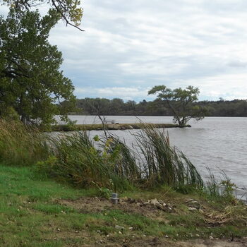
Ottawa Fishing Lake Kansas |
Fort Smith Trolley Museum Fort Smith Arkansas |
Last Sunset at Elk City Lake Park Camp |
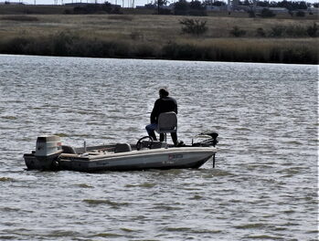
Fishing at Elk City Lake Oklahoma |

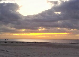
Sunrise over Gulf Port Mississippi |
Grand Bay Alabama Welcome Center |
Florida Welcome Center
On the way we had 2 or 3 days of fair weather before the front hit our locations.
Oklahoma was good for about 3 days and then we went straight across Interstate 20 through Arkansas to Louisiana where we stopped again for 3 days.
The cold front found us and again we headed south to Gulf Port Mississippi and again got 3 days before being chased to Florida with one freezing stop in Alabama.
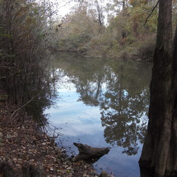
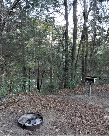
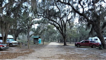
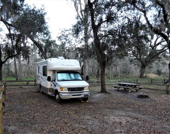
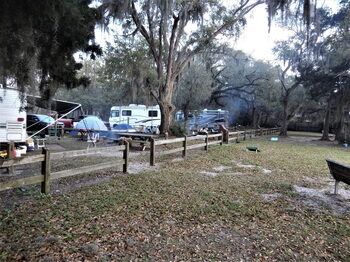
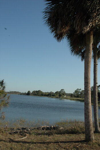
Deep Creek Preserve near Arcadia Florida
December 13, 2019 (Happy Friday the 13th)
Conestoga Charlie and company are almost recovered.
The Campground featured today is Deep Creek Preserve near Arcadia Florida.
Southwest Florida Water Management is the managing agency, and located at 10797 SW Peace River Street, (Latitude N-27.059072 Longitude W-082.022021.
There is a portable chemical toilet and one faucet that will dribble out non-potable water.
The campground is free but requires a reservation obtained online from
https://www.swfwmd.state.fl.us/recreation/deep-creek-preserve
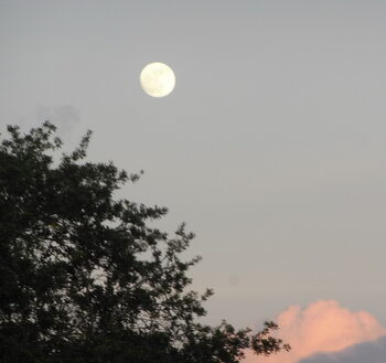
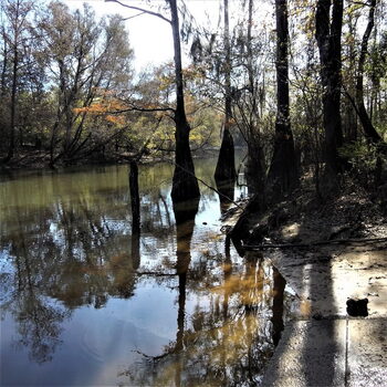
Out Our Window Last Full Moon of the Decade |
Out Our Window First Night Deep Creek Preserve FL |
Plenty of Room at Deep Creek Preserve Florida |
Another Neighbor at Deep Creek Preserve Florida |
Deep Creek Preserve Florida |
Picturesque Camp at Deep Creek Preserve Florida |
The grounds are very well maintained and loaded with beautiful trees laden with Spanish moss.
There are plenty of exercise opportunities and the weather should be mild most of the rest of the winter season.
Neighbor With Solar Panels at Deep Creek Preserve FL |
Spacious Accomodations at Deep Creek Preserve Florida |
First Night at Deep Creek Preserve Florida |
First Night Sheltered by Tree Deep Creek Preserve Florida |
Moved for better Solar Coverage |
Out our window the rest of our stay at Deep Creek Preserve |
The road nearby does not pose any obtrusive noise and down the road at the Peace River edge and a homey little place called, Nav-a-Gator Bar and Grill.
Open from Sunday to Thursday 11-to 9 Friday and Saturday 11-10.
Check out specials.

Nav-a-Gator Restaurant |
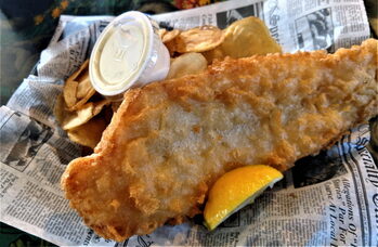
Fish and Home Made Chips at Nav-a-Gator Restaurant |
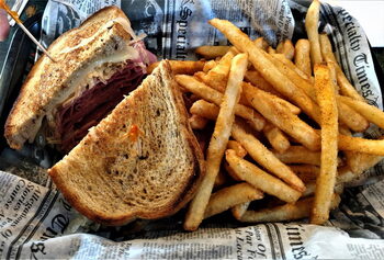
The Big Reuben at Nav-a-Gator Restaurant |
Nav-a-Gator Restaurant
For travelers in the Gulf Coast area of Florida, it is a very good location and we are having a pleasant stay in spite of just recovering from the RSV virus that kept us down for almost 8 days. (This turned out to be COVID-19)
Bayside Campground, AKA Grassy Point
March 8, 2020
Conestoga Charlie arrived at Bayside Campground, AKA Grassy Point.
(GPS Coordinates N 30.515179 W -87.006233)
The Campground is free but reservations must be made through Florida Fish and Wildlife Conservation Commission.
There is an overflow available of a first come basis.
The grounds are reached down a well maintained dirt road and each camp site is numbered. The bay is open and there is a day use area as well as a group campsite. (Caution the GPS may not indicate the turn on Choctaw Field Road!)
Access to Bayside Campground - Escorbina Point is 4 miles of this road |
Our Campsite with Table and Fire Pit |
Other Campers at Bayside Campground - Escorbina Point WMA |
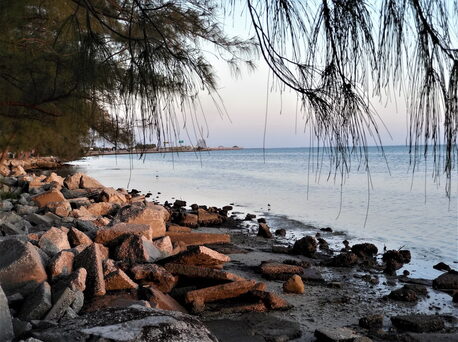
Along the Beach Bayside Campground - Escorbina Point Florida |
Pier at Bayside Campground - Escorbina Point Florida |
Closeup of our Campsite at Bayside Campground |
There are 2 chemical toilets, trash cans, and the rest must be supplied by the camper. Each site has a table and fire pit.
Self Contained RV’s are highly recommended.
Fallen Tree Along the Beach at Bayside Campground FL |
Evening Camp at Bayside Campground - Escorbina Point WMA |
Setting Sun and Bay View |
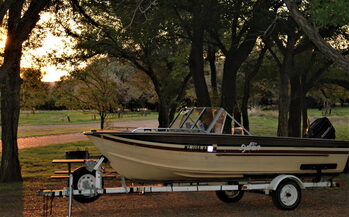
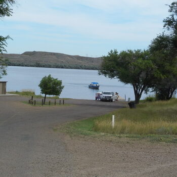
There is plenty of water access for small boats. We will try out our fishing poles. Also the kayaks will be used for the first time in 20 months!
There are no size limitations and there were some Class A’s 5th Wheels as well as a tent or two!
Our first night the fog blocked the sunset and the moon rose early.
It will be interesting to see how our solar generation fairs out with all the tree shade.
The camp sites are all well shaded for the summer comfort!
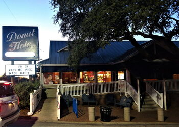
Dinner the Night before at the Donut Hole Destin Florida |
Inside the Donut Hole |

Some of the Goodies at the Donut Hole Destin Florida |
Mystic Springs
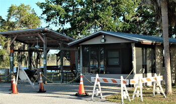
February 1, 2021
The water district made some dubious “improvements” since our last stay. They have built structures that just seem to have no purpose rather than limiting parking at each camp site! There is room for a Class A at only one site now!
The structures also limit the ability to park for sun exposure (for solar panels) which forced generator use for 3 of our 5 days. It is unclear if they intend to add a roof but as they stand, the structures do nothing to add to the campground and they are too low to park under them. (See Photos)
|
Other Campers at Mystic Springs |
Using Portable Panel in an Attempt to Charge in Tree Shadow |
|
Craig and Andrea's Class A and new Structure |
New Addition to Mystic Springs was Built on the Only Level Spot in this Campsite |
 | ||
 |
There is a boat ramp and chemical toilet with trash receptacles. The toilet is cleaned and emptied on Fridays and was a bit full when we arrived on Thursday. This campground is handy for trips in and out of Florida and is also a good stay for transients traveling through on Interstate 10.
The Campground is free but reservations must be made through https://www.nwfwater.com/Lands/Recreation/Area/Escambia-River/Mystic-Springs
During winter months reservation can be scarce.
Sunshine Skyway Turnpike and Skyway Fishing Pier
April 14, 2021
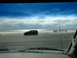
Conestoga Charlie has a real treasure for those traveling in Florida.For the price o the toll, access to the Sunshine Skyway Turnpike and Skyway Fishing Pier, (Two Axel Vehicles are $1.50.). There are 2 rest stops and both have north and south access to each pier. The piers are the old highway that led to the original bridge called the Sunshine Skyway Bridge which collapsed after a freighter struck it May 9th ,1980.
Southbound I-275 toll bridge
 |  |
 |  |
Overnight parking at the rest stops are available for pull through. Cost is $4.00 for Pier access and $4.00 for fishing fee. Each end of the pier has bait shops and rental for fishing gear. There was lots of parking and some had their RV parked as well. It is billed as the longest Fishing Pier in the Country. We called the number given and reached the bait house. The manager informed us that people park RV’s often, and we found no other information.
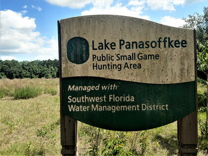
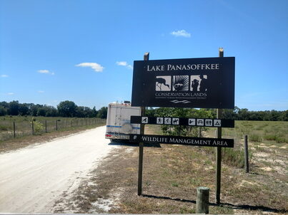
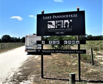
Lake Panasoffkee Conservation Lands Free Campground
May 23, 2021
Conestoga Charlie is solving a mystery. After one whole day chasing a red herring Twice!
We started by entering GPS coordinates as well as the address. Here was where the fun started as well as the mystery. We wound up at a campground but not where we were supposed to be (See Photos)
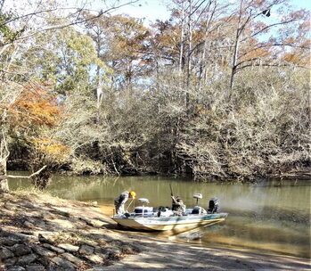
Lake Panasoffkee Camp and Hunting Area |
The Second try led to this road |
Lake Panasoffkee Camp and Hunting Area |
Parked at Lake Panasoffkee Camp and Hunting Area |
After some research we found another set of GPS Coordinates and headed out because the Campsite we were at did not match the photos, and neither did the road we went down. The supposed entrance the campground was impassable. Later in the I-75 Rest Stop we found driving directions, and decided to try again. What the real mystery is because when we arrived at the proper campground the address showed we were about 500 feet from the destination.
However, yesterday it took us about 25 miles the opposite way!
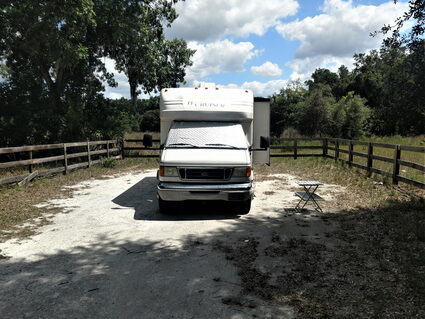
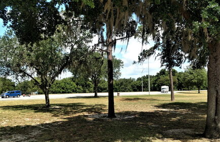
We were here for 2 days and it is a lovely Campground with flush toilets, water, horse stables, and humongous BBQ for large gatherings. I will still try to figure what is going on as obviously the two places should not have the same address!
To find the correct place here is the address given on the Southwest Florida Water Management District where the free reservations are obtained. (www.swfwmd.state.fl.us/recreeation/sites)
7519 NW 18th Way Wildwood FL 34785.
And GPS Coordinates at the Gate are N 28.865233 W 82.132236
However these are the correct driving directions.
From the north take I-75 south to FL 44 and exit Right to FL44. Right on FL44 2.8 miles and Left on NW18th way (The Gate is Visible!). From the South, take I-75 North to FL44 exit Left stay left for 1.2 miles then turn left on FL44 for 2.8 miles and arrive at the gate on the left!
Real Lake Panasoffkee Conservation Lands |
Flush Toilets at Real Lake Panasoffkee Conservation Lands |
Later at the Rest Area |

Our Campsite at Lake Panasoffkee Conservation Lands |
Lake Panasoffkee Free Campground
January 28, 2022
Conestoga Charlie is back in Florida at Lake Panasoffkee Free Campground.
Reservations are required for camping from Florida Water Management District where the free reservations.
7519 NW 18th Way Wildwood FL 34785.
And GPS Coordinates at the Gate are N 28.865233 W 82.132236
However our GPS attempted to take us back around to the closed gate ob the other side of the campground, use these directions.
From the north take I-75 south to FL 44 and exit Right to FL44.
Right on FL44 2.8 miles and Left on NW18th way (The Gate is Visible!)
From the South take I-75 North to FL44 exit Left stay left for 1.2 miles then turn left on FL44 for 2.8 miles and arrive at the gate on the left!
Real Lake Panasoffkee Conservation Lands |
our Campsite at Lake Panasoffkee Conservation Lands |
Flush Toilets at Lake Panasoffkee Conservation Lands |
Horse Stables at Panasoffkee Camp Equestrian Area |
Another View of Horse Stables |
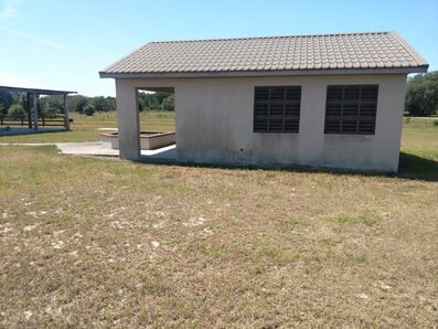
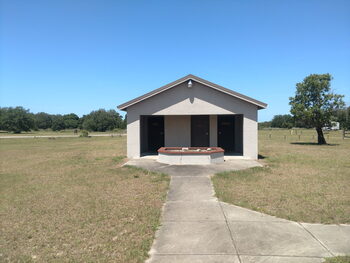
Camp Host Pavilion at Lake Panasoffkee Campground |
The general condition is very good and the amenities include flush toilets, non potable water (we filter anyway), numerous horse stables, and a Camp Host in season.
There are hiking trails nearby and large day use area.
Lake Panasoffkee Camp Equestrian Area |
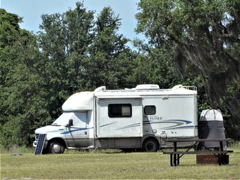
Pop Up Tent Trailer at Lake Panasoffkee Camp |
Lots of Horse Room at Lake Panasoffkee Campground |

Covered Picnic Area at Lake Panasoffkee Campground |
Peaceful Campsite at Lake Panasoffkee |
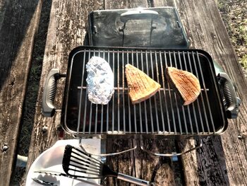
Grilling Swordfish on a Weber Portable Grill at Lake Panasoffkee Camp |
There were only 4 other people when we arrived.
This time of year the weather is less than ideal, we had rain 2 of the three days however we had lows of 28 degrees on the way.
The weather will be warming and the usual pleasant Florida winter will return.
Open Pit BBQ for Large Groups at Lake Panasoffkee Conservation Lands |
Shaded Picnic Area and View of Stables |
Our Tree and Table at Lake Panasoffkee Conservation Lands |
Babcock Web Florida Wildlife Management
March 2022
Conestoga Charlie found another hidden treasure near Punta Gorda, Florida.
(GPS N 26.856626 W 81.962969)
Take exit 158, Tuckers Grade from I-75 (29200 Tuckers Grade Punta Gorda FL)
The camping sites are to the right of the pay station; farther down the road is a gun and archery range.
Around the lake there is plenty of parking to fish in the lake.

Babcock Lake |
Another Stocked Lake at Babcock Web |
Angler's Tips at Babcock Web |
Babcock Web Camping Area |
Bicycle Tour Stop During our Stay |
Pit Toilets at Babcock Web Camp Area |
Boat Ramp at Babcock Web Lake |
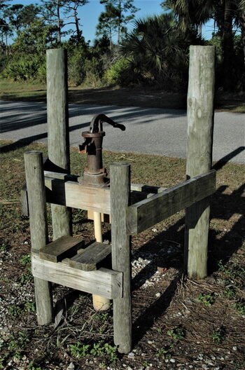
Working Hand Pump at Babcock Lake |
First Ranger Station at Babcock Web |
Babcock Web Fishing Lake
Reservations are obtained for weekends only from the Florida Wildlife Management and are free.
Prior to all the COVID restrictions Day Use Passes were available for $3 per day.
There is an onsite gun range past the old ranger station.
The main lake as well as surrounding ponds are stocked with Big Mouth Bass, Bluegill, Catfish, and Redear Sunfish.
No Gasoline outboards are allowed in any of the lakes.
There is a working “Old Style” hand pump however it’s posted Non Potable Water, Do not Drink!
The Punta Gorda Airport is close by and occasional there is minor jet noise.
Aside from that is is a very quiet campsite with little traffic noise.
Kansas
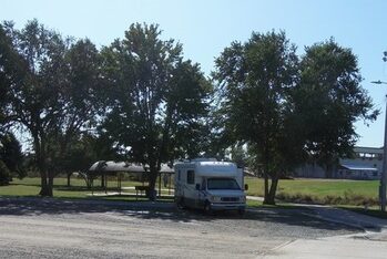
Airport Park, Concordia
June 19, 2020
Conestoga Charlie is at Airport Park US-81 North Cloud, Kansas (N 30.550686 W 97.655769) Near Concordia.
There is a Wal-Mart just across the highway.
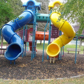
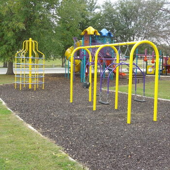
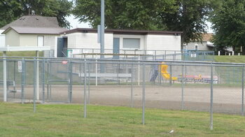
The park is expansive with pull through and pull in spaces, a large dog park, children’s playground, flush toilets and a dump station.
There are 12 pads with water and electric hookups.
There are also a number without hookups.
 |  |  |
 |  |  |
The campground is a donation campground for 7 days and longer for $100 per week with a permit from the city. The Highway and airport is right off the grounds and could have aircraft and traffic noise.
About 2 miles away in Concordia is the Orphan Train Museum.
The museum commutates the period from 1854 to 1929 an estimated 250,000 orphaned, abandoned, and homeless children were placed throughout the United States and Canada during the Orphan Train Movement.
When the orphan train movement began, it was estimated that 30,000 abandoned children were living on the streets of New York City.
Throughout the city of Concordia are sculptures of these rescued children with their stories.
Visiting the museum and walking through town is interesting and very informative.
It is a great insight into this period of history.
Ottawa State Fishing Lake
June 6, 2019
Conestoga Charlie and company are planning to make our first destination Ottawa State Fishing Lake, 1067 Lake Dr. Minneapolis Kansas, (Latitude 39.10891: Longitude -97.572942)
The plan is to stay and enjoy the cool Kansas weather compared to the current 90s+ in Texas.
This will be the third time we have enjoyed this campsite.
This campground is a beautiful peaceful respite with a 14 day stay limit.
The immediate goal is to meet up with some friends in Nebraska with a stop in “Minneapolis” Kansas and Concordia where there are 2 free campgrounds.
Last Year I was really looking forward to being able to compare performance with our added solar array, but we had 3 days and were literally run out by a sudden freeze at 22 degrees!
That was that freak cold front back in October 2019 that literally chased us almost all the way back to Florida.
This year we will have our full solar array (470 Watts) to compare however because we do not have direct comparisons it will not be as meaningful.
Since starting the solar experimentation we have done much research and learned much along the way.
Research has dispelled many myths especially about the use of batteries.
As many start out to return to our lifestyle and travel it will be interesting to see the effects of the recent COVID emergency.
Ottawa State Fishing Lake, in Minneapolis, Kansas
July 1, 2021
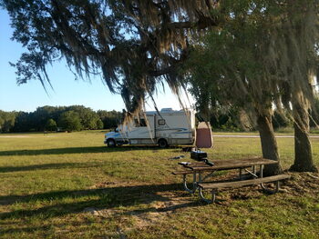
Conestoga Charlie camped at Ottawa State Fishing Lake, in Minneapolis Kansas (Yes Kansas!) This campground has a special place with us as it was the first place we used a solar panel.
The address listed is 937 200th Rd Ottawa KS 67467; however our GPS wanted to take us across the lake where there are mostly tent sites.
The GPS Coordinates N-39.109226 W- 97,572794 will lead to the pull through spots.
The facilities include a well maintained pit toilet, a community covered picnic area as well as pleasant scenery. The lake is surrounded by small campsites about 4 are accessible for “Pull Through” for Class A and Toad or 5th Wheels.
 |  |
 | 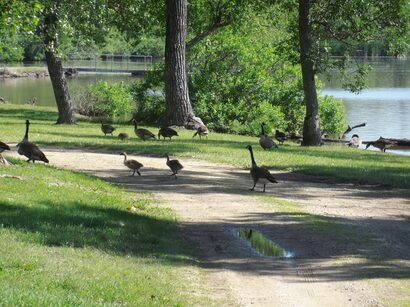 |
It’s a generous walk to the Pit Toilets for exercise. The first time we also did not have our kayaks yet. The Canadian Geese make a stop here and provide lively entertainment.
At night, this time of year, the trees were so full of “Lightning Bugs” it was like Christmas. On the whole it is a quiet peaceful stop and not far from Concordia, which has the Orphan Train Museum. This is a must see and about an interesting but little known part of US History.
MISSISSIPPI
Conestoga Charlie and our SunChaser is in Mississippi camped in Long Beach near Gulfport.
It is actually listed as a free campsite, and we have stopped here before.
There is a great view of the beach but the traffic noise is significant during the day.
The GPS coordinates will lead to our spot but there are several places along the beach.
(GPS N-35.49230 W-89.124059)
There is a Wal-Mart west of the location and along the road are some businesses such as Circle K and Waffle Hut.
In town is Cajun’s Fabulous Fried Chicken
112 Pass RD Gulfport and was under $12 for a truly fabulous buffet dinner.
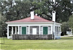
Not far from the Campsite in Biloxi is Beauvoir, the last home of Jefferson Davis.
On site is a small museum and library with tours daily.
This is a fine example of Antebellum homes of the period.
There are a number of trash cans along the beach but mostly this is a quiet restful Boondocking camp.
Long Beach, Mississippi |
Sunrise over Gulfport, Mississippi |
Long Beach, Mississippi |
Beauvoir the last home of Jefferson Davis Biloxi, Mississippi |
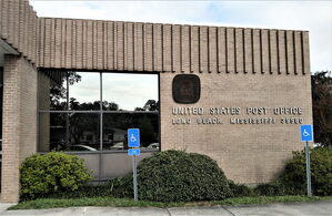
Post Office Long Beach, Mississippi |
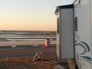
Gulfport, Mississippi |
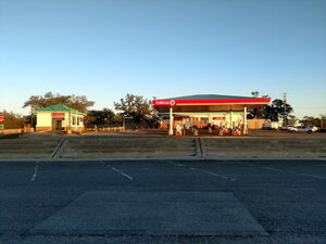
Circle K across from our campsite on the beach at Gulfport, Mississippi |
Another sunrise over Gulfport, Mississippi |
Leaving Gulfport, Mississippi |
Montana
Superior, Montana
June 29, 2018
Today's stop is Superior, Montana. We stayed at the truck stop for the weekend as we had to wait for the local propane station to open. Beautiful Alpine Village town surrounded by pine covered hillsides. We had a great dinner at Durango’s. The special today was Prime Rib, and there was enough to bring back for Prime Rib sandwiches the next day,
June 30, 2018
Also today was mostly a lazy day while waiting for the propane dealer to open Monday.
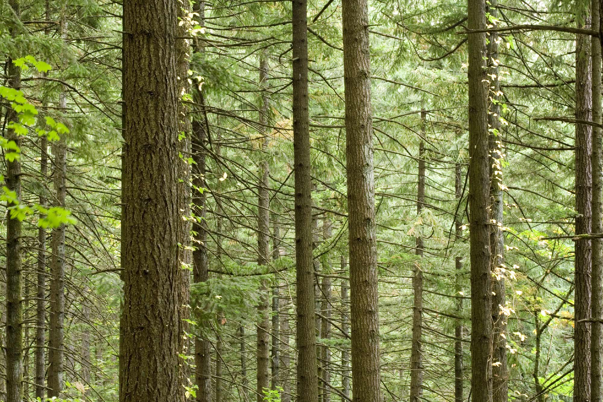
Superior Has the Clark Fork River running through the middle of town. Named for William Clark of the Lewis and Clark Expedition, it flows some 310 miles into the Columbia River. Just before my kayak trip down the Missouri River, I read a book titled “River Horse” by William Least Heat-Moon about his journey from New Orleans to the Pacific Ocean in a small power boat. He traveled through here on his journey as did Louis and Clark. Above the Interstate next to the rail line the view of the city is shrouded by the rows of pine trees growing along the road. Traffic on the Interstate is rather slight compared to what we are used to! Very Peaceful.
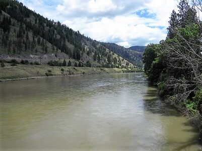
Clark Fork River Superior, MT |
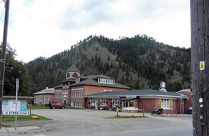
Downtown Superior, Montana |
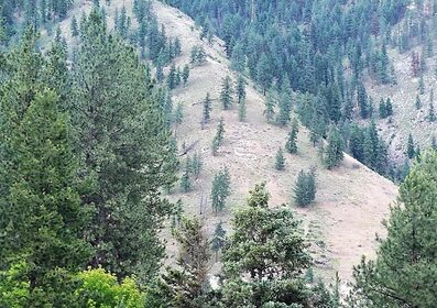
Mountains above Superior |
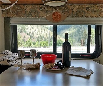
Relaxing View out of our Window and Wine at Superior, Montana |
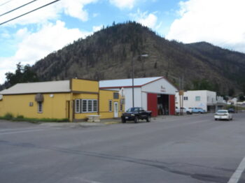
Downtown Superior, Montana |
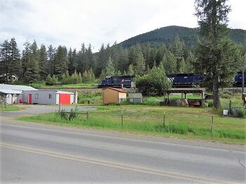
Train in Superior, Montana |
Fort Peck
August 28, 2018
Fort Peck Dam is a small well kept campground just off the back side of the dam.
Originally, it was found by GPS Longitude and Latitude Coordinates - Lat.48.016257, Lon-106.43867
However, it is easy to find. After crossing the dam, pass the Corps of Engineer’s Campground (Downstream Campground) on Yellowstone Road and just past this campground is the Dump Station (Free!). Continue on Yellowstone Road and turn Right on Winter Harbor and just before the boat ramp there are 5 free camp sites 14 day limit.
This is what might be called a basic or wilderness site. No electric or water but there are pit toilets on sight, The free dump station is less than 2 miles away and the town of Fort Peck is also within walking distance. The Downstream Campground (Corps of Engineers) with America the Beauty Senior Discount Pass was $18 per night with full hook ups. (More if you are not senior)
Many times in the past I have used such campgrounds that had little more than fire rings, perhaps a table, and a pit toilet, and considered myself lucky to have those accommodations. In the motor home we need much less and on this trip several times had less.
Parked at Fort Peck, Montana |
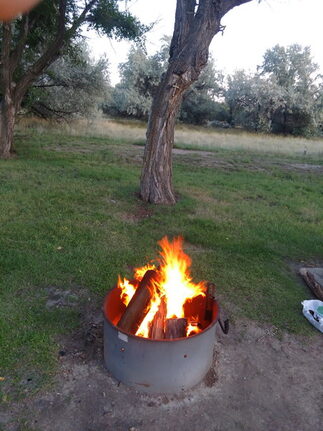
Evening Campfire at Fort Peck |
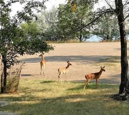
Deer in Our Campground Fort Peck, MT |
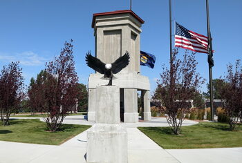
Eagle Sculpture at Fort Peck Memorial |
Unless you are much better off than we are, finding inexpensive or free campsites is necessary for being on an extended trip.
Much like dropping an anchor when sailing.
Today, as more and more people want a “Piece of the Action” it gets harder to find an inexpensive nesting place.
This discussion brings me to what we used to term in those days as Coyotie Camping.
(Misspelling Intentional) Coyotie Camping by definition is spending a night (or longer) in unconventional spots and remain unmolested. (Read NOT Campgrounds)
Note: some of my trips were by motorcycle and kayak as well as sailboat. It was pure luxury when I moved from using a tent to a Volkswagen Westfailia. One must get creative for this.
Here are some thoughts: One time while on a motorcycle trip I spotted an abandoned highway maintenance station with a nice flat area well away from the road. Another time on the same trip, there was an abandoned warehouse with plenty of shelter from prying eyes. In the Volkswagen it was much easier, a simple For Sale sign in the front window would give it access to many places. One time even a parking lot next to a police station. I have often wondered how many called the number on the for sale sign?
Fort Peck
September 2, 2021
Conestoga Charlie Is at Fort Peck Dam in the Flood plain Boat Ramp Campground.
This is our fourth year to camp here.
It is a Dry Camp with Pit Toilets and Trash Pickup, (Boondocking)
We found it by GPS Coordinates the first time, but it is very easy to find without them. (GPS Latitude 48.016257 -- Longitude -106.43867)
Basically find the road right across from the one up to the city that has the warehouse for the Dam Maintenance and look for the boat ramp with the dumpster and pit toilets. (Winter Harbor Road)
Back at Fort Peck August-September 2021 |
Sunrise Through the Trees at Fort Peck 2021 |
Extra Solar Panel Deployed at Fort Peck August September 2021 |
Boat Ramp at the Campground Fort Peck, Montana |
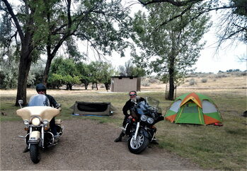
Doug and Ron Motorcycle Camping Next to Our Camp |
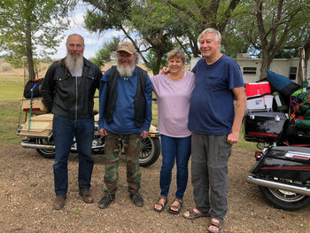
Doug and Ron Motorcycle Camping |
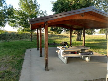
Pavilion at Fort Peck |
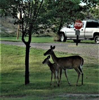
Visiting Deer at Flood plain Boat Ramp Campground |
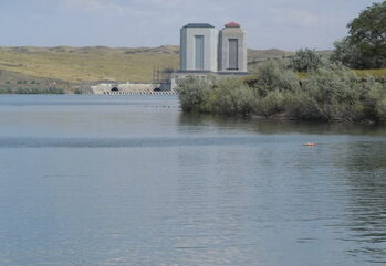
Back Side of the dam |
There is a free dump station and potable water station within 2 miles next to the Corp of Engineers’ Campground and Glasgow Montana is a short drive away with good shopping and very reasonable propane.
From the campground the City Center and Post office is one mile up the hill.
Our stops are long enough to forward and collect our mail.
We walked up the hill a number of times during our stay.
Dump Station at Fort Peck Dam Montana |
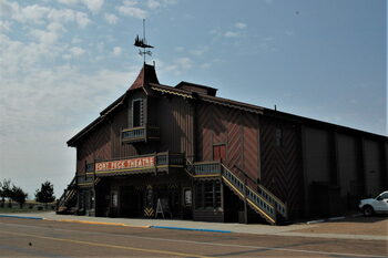
Fort Peck Playhouse |
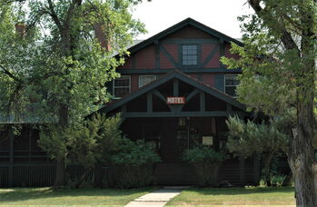
Historic Fort Peck Hotel |
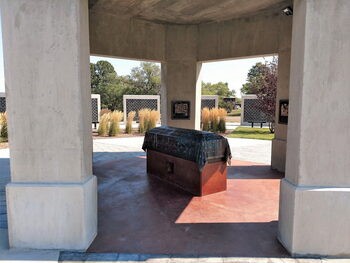
Fort Peck Veterans Memorial |
Other Campers at Fort Peck August 2021 |
Fort Peck Corp of Engineers |
View to Fort Peck Lake Montana |
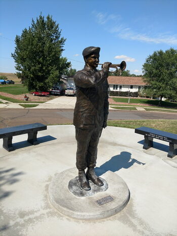
Bugler Representing the Playing of Taps at Fort Peck Memorial |
Close up of Representing Honors at the Memorial |
The hotel recently was bought by new owners and has a Buffet on Thursday through Sunday.
The dinner we had consisted of a choice of Pot Roast, Baked Chicken, Stuffed Pasta Shells, Choice of potatoes with a salad bar and dessert all for $15 each.
This year we took advantage of the boat ramp to launch our kayaks.
There is plenty of trailer parking for those who have boats.
Last year we came from the west and stopped at Vandalia Glasgow Rest area about 15 miles east of Glasgow, MT.
The stop provided a day to organize the next day’s shopping, Propane fill, and laundry, before heading to the campground.
From the east we stopped at the Wal-Mart in Williston North Dakota for shopping and a visit to Lonnie’s Road House (great foot fun people.)
Last minute fuel and Propane is in Wolf Point 46 miles east.
The nearest Gas Station is about 8 Miles west of the campground.
This year our Solar System was increased by adding another 300 Watts.
This year we have a total of 570 compared to last year’s 270 Watts.
We managed last year and this year the extra is giving us that extra margin during poor weather.
All around us everyone is running generators and our motor home is silent!
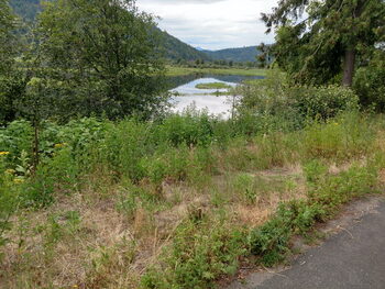
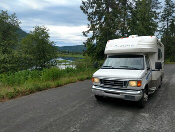
Cabin Creek, Washington & Big Eddy Campground, Montana
July 14, 2019
Leaving Washington and Idaho the plans to stop by a friend’s place was changed so an alternate camp was found in Montana.
Conestoga Charlie is going to publish this sometime when Internet Connections are restored.
Our camp is along the Clark Fork River 6 miles from Idaho.
We had planned to report on some campsites north of Bayview Idaho however with the change of route some interesting things were found along Idaho 200.
Just before the Montana Border there were literally a hundred or more old derelict cars along side of the road.
 | 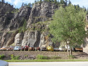 | 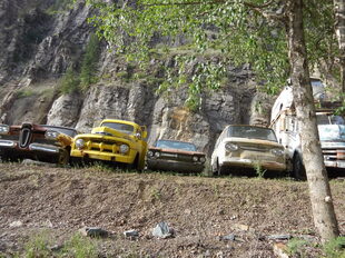 |
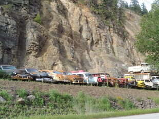 | 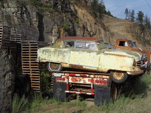 | 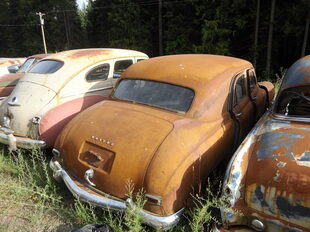 |
We stopped and photographed many at the second site.
Just 6 miles from the Western border of Montana is the Big Eddy Campground and Recreation area complete with a boat ramp day use and 6 very nice campsites with fire pits and picnic tables.
It is easy to find off the Highway as it is well marked 6 miles west of the Idaho/Montana border off ID 200
(GPS Lat-48.06611 Lon-115.92463)
Pack River along ID 200 |
Parked Along Pack River along ID 200 |
Entrance at Big Eddy Camp and Recreation Area |
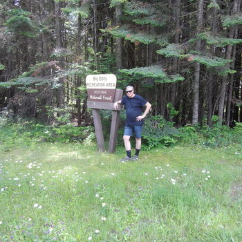
Me at the Enterence to Big Eddy Camp and Recreation Area |
Big Eddy Campground Montana With Solar |
Big Eddy Campground Montana |
Solar is not very promising as can be seen from the photos, tall trees surround the campsite and it has been cloudy most of the day.
This was very similar to the conditions in Cabin Creek, except there was a bit more open space there!
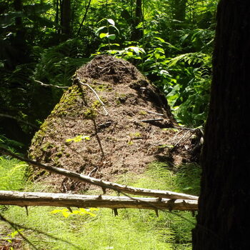
Giant Ant Mound at Big Eddy Camp Montana |
Cabin Creek Washington With Solar |
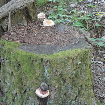
Tree Mushroom at Big Eddy Montana |
For those who have been following the solar parts of the blog know we are only using a 100 Watt panel.
The goal is to eventually have 400 Watts, but even with that under these conditions it would fall short of powering much more than we already use.
An upgrade of the controller would help as well, however considering there is only about $175 invested so far it is doing well!
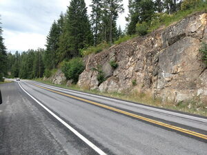
Today’s photos are from Eastern Idaho and Western Montana along ID-200.
Finlay Flats Recreation
August 2, 2019
Conestoga Charlie with camping and solar news from Finlay Flats Recreation area in Montana.
The Campground is situated about 20 miles West of Thompson Falls at Milepost 41. Easy to find - turn at the Gas Station and Store (Closed) and just follow the road to the river. (GPS-- Lat-47.775151 Long-114.084083)
First and foremost I’d like an explanation of why all the solar stuff started working.
It had stopped and everything we did would not get the controller to turn on again.
We worked on it for 3 days before we left Thompson Falls and even ordered another controller (100 AMP)
The day before we left I even disconnected each panel in turn checked voltage and then put it all back together to wait for the new controller.
The next morning and every day since, it has been working flawlessly.
Peak Voltage 14.2 overnight 12.2 Volts.
All during the day it stays, even with a few clouds that drifted in.
Dawn says “It’s PFM (Pure F*****g Magic),” which is a generic explanation for electronic devices that suddenly work!
Finlay Flats Recreation Area is a fairly large campground with a boat ramp and dock as well as a protected swimming area.
There are pit toilets but no pump out or potable water.
Each Camp site has a fire pit and picnic table.
Today’s photos from Finlay Flats

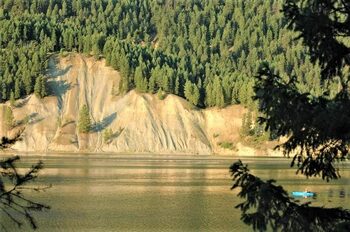
Blue Slide at Finlay Flats Recreation Area |
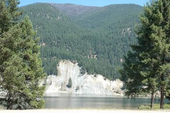
Cliffs at Finlay Flats Recreation Area |
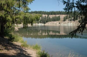
Finlay Flats Recreation Area |
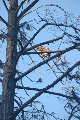
Brown Eagle at Finlay Flats |
Finlay Flats Montana |
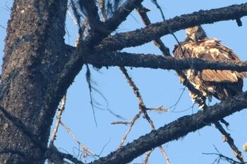
Brown Eagle at Finlay Flats |
Blue Slide, Finlay Flats |
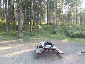
Campsite Finlay Flats |
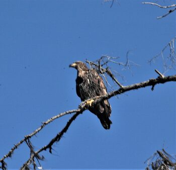
Close up of Brown Eagle at Finlay Flats |
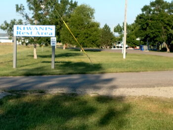
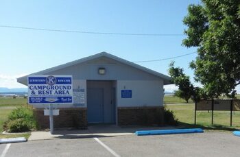
Kiwanis Rest area and Campground
August 16, 2019
Conestoga Charlie reporting from the beautiful Kiwanis Rest area and Campground at area 86398 US-87 Lewistown, Montana.
It is registered in freecampsites.net with a 10 day stay limit.
The grounds are well maintained and have a donation box to help with the upkeep.
The location is next to a municipal airport with an occasional commercial jet and a few small aircraft landing and taking off to provide some entertainment.
 |  |  |
 |  |  |
 |  |  |
There is a Bike/Walking trail as well as concrete picnic tables for each site.
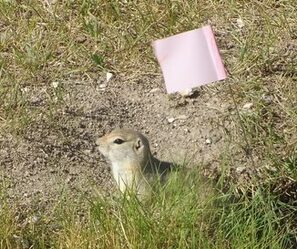
There are tiny visitors who have their homes marked with little flags to prevent driving over the Prairie Dog Holes.
One of the little guys was intent on watching Dawn prepare breakfast through our screen door.
Our Fort Peck destination was put on hold as this was such an interesting place to visit with the Charles M. Russell wildlife preserve and other attractions.
Lewistown is a major hub of the Judith Basin and both the town was named for Meriwether Lewis and Judith Basin and river for William Clark’s future wife, Julia (Judith) Hancock.
Lodge Grass Campsite, White Arm Park
September 20, 2019
Conestoga Charlie with the last report on the Lodge Grass Campsite, White Arm Park.
I suggest that it is good only for an overnight stay and only in one is desperate!
The GPS Coordinates (Lat 45.312908 Lon -107.362668) however it is very easy to find.
Simply take the Lodge Grass Exit from Interstate 90, go straight into town and turn left at the IGA and go half a block to the entrance!
However between the excess trash, inebriated drivers, panhandling, suspected drug deals, not to mention the very close track and loud whistles from the trains through the night reconsidering is a good option.
On our way towards Billings from Lewistown, we found a very interesting “Rest Stop” at Ryegate Montana off US 191.
It is only a parking area but was a great lunch stop!
We are currently in Wyoming and the next stop will be in Nebraska.
Nebraska
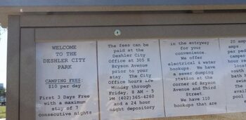
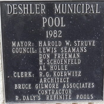
Deshler City Park
October 6, 2019
Conestoga Charlie is leaving Nebraska with the last stay at another Nebraska gem park.
First 4 days free after than $10 per night.
Deshler City Park Deshler Nebraska (Lat 40.135753 Lon -97.721908)
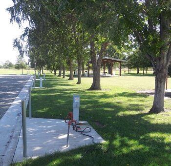
Amenities include Electric, City Water, and trash pickup.
The bathrooms are open but a bit of a walk away.
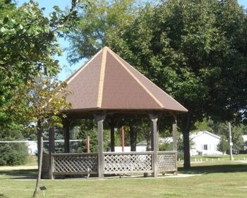
The park has multiple pavilions with tables and the High School arena is right behind the park.
We were treated to the High School Homecoming game with halftime marching band at halftime!
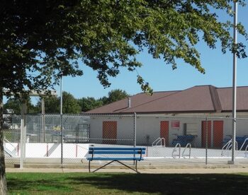
Our stay was quite peaceful, however I would expect more activity during the season when the pool is open and more people are populating the park.
During our travels, it is interesting to note which states are RV friendly and also which states provide for r3ecrteation.
The states mentioned are not necessarily in order of our travels.
Washington: many of the rest stops had free RV Dump stations and did have unimproved camping spots.
Free RV Dump stations were also found just outside Winnemucca, Nevada (I-80) and the rest stop just before Cheyenne, Wyoming.
 |  |  |
 |  |  |
 |  |  |
 |  |  |
 |  |  |
Montana had many great free campgrounds that were mostly primitive with pit toilets.
Near Lewistown, the Kiwanis maintains a 10 day limit campground just outside of town.
Fort Peck has a free Dump Station within short distance of the campgrounds.
Big Eddy and Finlay Flats on MT 200 just outside of Thompson falls are just beautiful,
Wyoming had a really nice one in Riverside Park in Douglas Wyoming that had RV Dump, Available water, and nice Hot showers.
Florida (our home state) has RV Dump stations in many rest stops.
However so far in all our travels only Nebraska has been so accommodating with not only a place to park and dump holding tanks but providing full hookups as well.
Three of the ones we stayed at allowed 2 to 4 days free and $10 per night after.
Deshler City Park
July 28, 2021
Conestoga Charlie is in Deshler, Nebraska with another “Free Campsite” Report.
Locate by GPS Coordinates N40.135753 W-97.721908 or 4th and Park Streets.
There are plenty of spots and a dump station in town.
There is a 4 day limit for free parking and continued parking is available for $10 per day.
This and other free campsites can be found on our web page at no cost to the user.
Just use the "where to camp" tab: Boondocking SunChaser http://boondockingsunchaser.com/
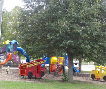
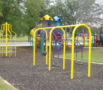
When the pool is open showers may be had for the $2 admission price. The park has a complete children’s playground and covered picnic tables.
The fairgrounds are a comfortable walking distance and there was a model railroad meet while we were there.
 |  |
 |  |
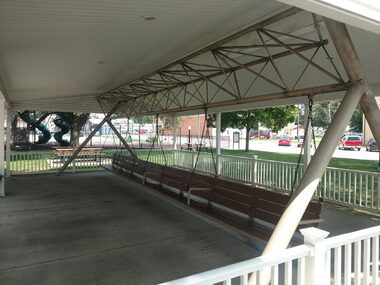
The nearby town of Hebron is the home of the World’s Largest Covered Porch Swing. York is just up Highway 81, and all three have interesting dining possibilities.
 |  |
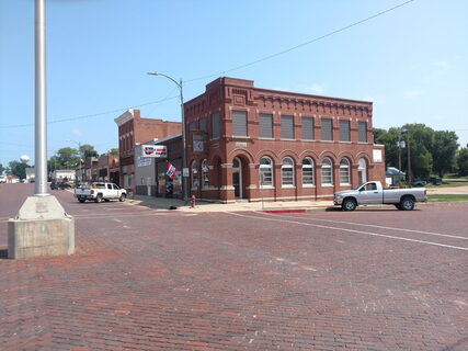
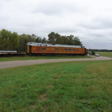
While traveling on Highway 81 be on the lookout for a Locomotive and Railway Passenger Car not far from York. Not many people have a locomotive in their backyard!
Aurora
July 13, 2021
Tomorrow July 14, it will be a year since our visit to Aurora.
Everything feels like old home week for Conestoga Charlie as we visit for the fourth time to Streeter Park in Aurora Nebraska
(Lat 40.873058 Lon 98.002777)
Take the Aurora exit from I-80.
There is also a Love’s Truck Stop at the exit with Diesel and Propane.
At Q Street (Mc Donald’s on the corner) turn Left and then right, just past the Public Swimming Pool.
The Campground is limited to 4 days and is by donation. The amenities are electric hookup, flush toilets (Short Walk at the end of the pool), water hookup, dump station, and free Wi-Fi! The Wi-Fi is public and can be a bit slow at times.
 |  |
 |  |
The town square is a comfortable walk and there are restaurant options well within comfortable walking distance.
We were here in June, 2019 during the “A-ROR’N Days” but because of COVID last year, it was canceled.
The reason for our delay, 2019, was to get dental work at the Omaha Dental School but it was closed for COVID as well.
This year, we missed it by two weeks! (June 24-27)
July usually finds us much farther north.
This year the campsites are mostly empty. There are only 3 of us here, a travel trailer and our Class C and the site we are on is close to perfectly level. There were 4 people in tents that left early in the morning along with a travel trailer.
One of our favorite restaurants in town, Rath's Cafe, and only serves dinner on Fridays and closes at 4:00 PM all other days and prices are quite reasonable.
We don’t have a Toad, so it’s great that things are within walking distance, an ACE hardware and the Aurora Mall that has a fabulous grocery store together in the same building, as well as providing great exercise!
Most likely, this will be a stop for us on the way back to our boat in Florida as it was last year!
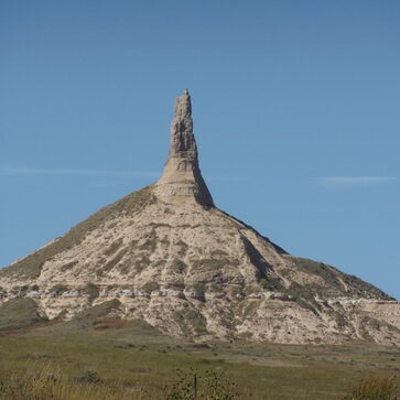
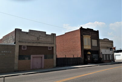
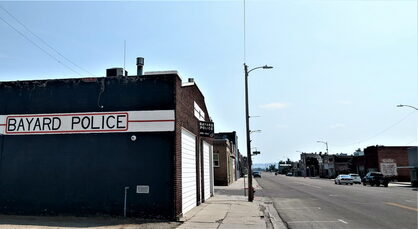
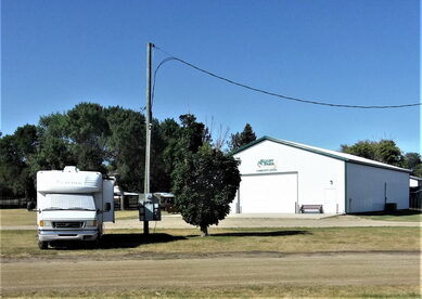
Bayard City Park
August 5, 2021
Conestoga Charlie has returned to Bayard on the way to South Dakota.
Bayard, Nebraska provides two days of free camping next to the park,
N-42.762306 W-103.32273.
However, it is quite easy to find, Look for the water tower and the campsites are right next to it.
Additional days are available for $10 per day.
Both 30 and 50 Amp electric is provides as well as water.
There is a dump station in town but we have not used it yet.
The park has tennis and basketball courts and a playground for children.
The swimming pool is open in season but is currently closed in preparation for the start of school.
 |  |
 |  |
The town is a walkable distance from the RV sites.
As is our custom we have our mail forwarded to such towns whenever possible as small towns provide better service with less hassles.
 |  |
We have had St. Brendan’s Isle for 13 years now.
This and other free campgrounds are listed on our web page, as well as many free solar tips at, Boondocking SunChaser http://boondockingsunchaser.com/
North Dakota
Pierce County Fairgrounds
August 10, 2021
Conestoga Charlie survived Sturgis to arrive in Rugby, North Dakota. The news media claims 700,000 motorcyclists will attend this year!
In 2001 I was one of "them" when I rode my Harley Sportster from California to attend.
The Pierce County Fairgrounds located at (GPS N-49.372746 W-99.992973) is rather easy to find as the entrance is directly across from the huge grain elevator which is visible from the entrance of town on US-2 at the geographical center of North America.
 |  |
 |  |
There are two great restaurants and a Auto - Truck stop with a dump station directly across the street from the marker.
The Prairie Village Museum is also near the Restaurant Monument Complex and allows overnight parking for RV’s with admission.
 |  |
 |  |
The Prairie Village Museum is an absolute “Must See” and probably has the most extensive collection of buildings and artifacts short of the Miracle of Americas Museum in Polson Montana! (Also a must see when in Montana)
Both restaurants are good food reasonable prices. The American one features home baked and home cooking and is quite popular with the locals.
Parking and RV at the fairgrounds will be a snap even for large 5th Wheels and Class A’s with toads. For those without Toads we were informed from a local Bar and Grill (Northside Lounge) if a ride is needed the Rugby Bus will pick you up and take you around town for $1 per person and $10 per person to Minot! Call (708) 208- 0153
All the sites are quite open and there are plenty of both 30 and 50 Amp plugs as well as 20 Amp ground fault plugs.
Donations of $15 per day are asked for those who hook up to power.
Bathrooms with hot showers are also located next to a picnic area.
All in all a great place to visit.
OKLAHOMA
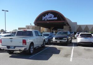
Lucky Star Casino in Concho Oklahoma (El Reno)
October 21, 2019
Conestoga Charlie is enjoying the hospitality of Lucky Star Casino in Concho Oklahoma (El Reno).
There are limited campsites with all hookups free for 4 days as well as some overload parking with no hookups.
Physical address is 7777 N .Highway 81 El Reno OK
The Coordinates are Latitude N 35.599045, W Longitude -97.962128 about 10 miles north of Interstate 40.
We came here from touring the Route 66 Museum in Elk City.
We did stop over for dinner in Elk City before driving to El Reno.
 |  | |
| | |
Our stay here is for a break in travels to do some planning and figure the next stops.
After leaving Elk City Lake a trip to the Route 66 museum is highly recommended.
There are 3 museums located on the grounds and are all included in a very reasonable entrance fee.
 | | |
| | |
The location of the RV parking s directly across from the casino entrance and spots are clearly marked with hookups on a first come basis.
It is a nice break from I-40 travel and who knows one may “strike it rich!”
Cherokee Casino and Hotel in Roland Oklahoma
October 24, 2019
Conestoga Charlie is in the rain searching for a small leak at the Cherokee Casino and Hotel in Roland Oklahoma. (Latitude 35.408157 Longitude -94.525890)
The Cherokee Casino and Hotel has a great buffet dinner and provides a perfect stopover for two days as we head further east and south.
Sign up for the “Players Rewards” and in return receive a card and 2 days RV Parking.
The Hotel and Casino are easily spotted from Interstate 40 and there are plenty of billboards advertising it as well.
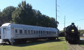
In nearby Fort Smith Arkansas there is a Trolley Museum and a National Historic Site to visit on the way.
Today’s photos are the last of the Route 66 Museum and some from previous museums.